|
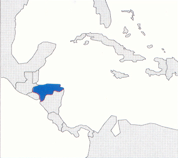
Location: Central America
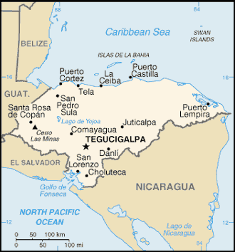
Capital: Tegucigalpa ( 820.000 inhab.)
Main Cities: San Pedro Sula, Choluteca, Ceiba, Comayagua
Population: 6,480,000
Area: 112,492 km2
Coin: 1 lempira = 100 centavos
Languages: Spanish
Religions: Roman Catholic, Protestant
The Independence's Year: 1838
Mountains: Cerro de Las Minas
Lakes: Yojoa
|
 |
|
Country of central America among Guatemala, El Salvador and Nicaragua, primarily mountainous, included between the Sea of the Caribbean and the ocean Pacific.
It is a poor, but dignified country, with great plantations of bananas, walnut-trees of coconut and coffee.
The economy primarily pulsates around the two great centers: Tegucigalpa, convulsive and messy city and S.Pedro Sula, more dynamics and tidy than the Capital.
The continental part of the nation doesn't introduce particular attractions, but in the Sea of the Caribbean the beautiful islands of the Gulf emerge, that have their pearl in Roatan.
| * Information and news of every kind (and photographic documentation) about Honduras are to disposition of the partners of the Worldwide Geographic Academy: info@accademiageograficamondiale.com |
|
|


