|
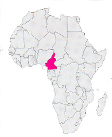
Location: Africa
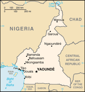
Capital: Yaoundé ( 1.400.000 inhab.)
Main Cities: Douala
Population: 15,000,000
Area: 475,442 km2
Coin: 1 CFA franc = 100 centimes (no longer used)
Languages: French, English, Bantu
Religions: Animist, Christian, Moslem, Protestant
The Independence's Year: 1961
Mountains: Mountain Camerun (4070 ms.), Highland of the Adamaoua
Rivers: Sanaga, Nyong, Benue
Lakes: Ciad |
 |
|
Great state (wide once and a half Italy) of the central Africa that develops from the Gulf of Guinea to the Lake Ciad.
The coastal band is level, but there is isolated the Camerun Mountain, tall over 4.000 meters; while the inside is constituted in prevalence from the highland of Adamaoua and from low mountains across borderline with Nigeria (Mounts Mandarà and Mounts Atlantika).
The capital is Yaoundè, but the main city is Douala (great port and important airport), where live more than two millions of inhabitants.
The nations is really green and fertile in the south with a lot of big cultivations of bananas, pawpaws, coffee and cocoa and waterless and poor in the northern area.
|
* Information and news of every kind (and photographic documentation) about Camerun are to disposition of the partners of the Worldwide Geographic Academy: info@accademiageograficamondiale.com |
|
|